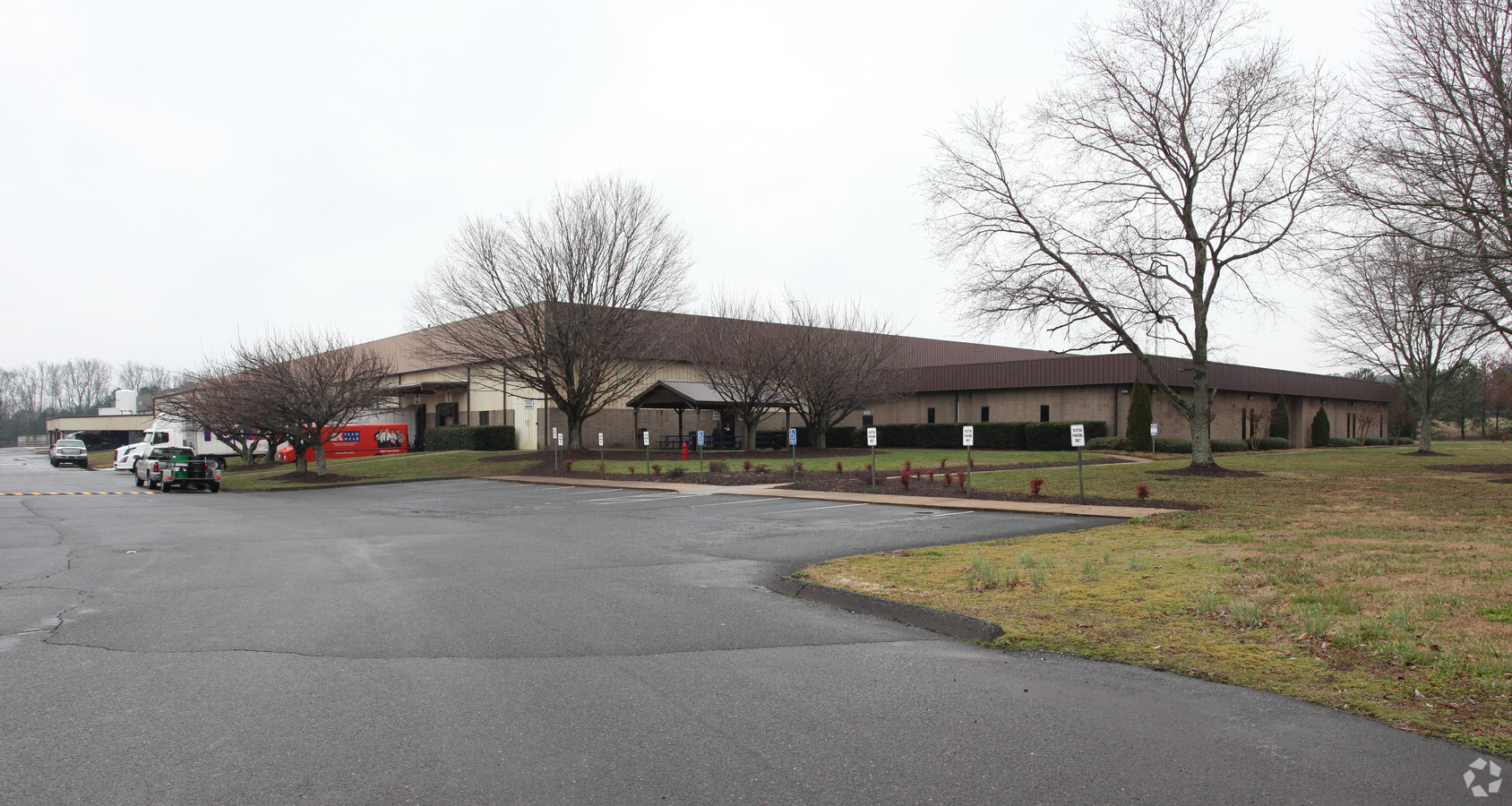
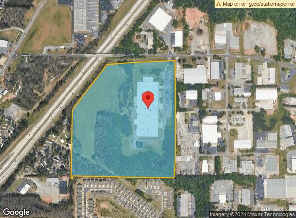
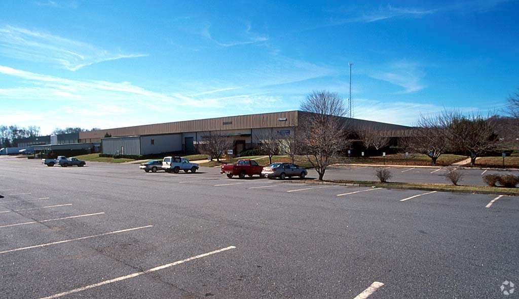
Property Record
2200 Pendley Rd, Cumming, GA 30041
NEARBY LISTINGS FOR SALE OR LEASE
Property Detail
2200 Pendley Rd
131-064
Old Atlanta Comm
Lightindustrial
2-1 418
X
Forsyth
13117C0141F
Georgia
2023
45.43 AC
2024
N Fulton/Forsyth Cnty
130512
Atlanta
211,599 SF
Atlanta-Sandy Springs-Roswell, GA
DEMOGRAPHICS near 2200 Pendley Rd
1 Mile
3 Mile
5 Mile
2024 Total Population
4,175
56,127
136,137
2029 Population
4,872
65,001
157,950
Pop Growth 2024-2029
+ 16.69%
+ 15.81%
+ 16.02%
Average Age
36
38
38
2024 Total Households
1,380
18,765
44,895
HH Growth 2024-2029
+ 16.59%
+ 15.84%
+ 16.13%
Median Household Inc
$113,686
$123,805
$130,957
Avg Household Size
3.00
2.90
3.00
2024 Avg HH Vehicles
2.00
2.00
2.00
Median Home Value
$418,609
$449,401
$463,802
Median Year Built
2005
2006
2004
Nearby Places
- Restaurants
- Banks
- Shops
- Fitness
- Groceries
Nearby Properties
Address
Land Use
TOTAL SIZE
Lot Size
Zoning
Address
Land Use
TOTAL SIZE
Lot Size
Zoning
8,848 SF
15.75 AC
PUD
Address
Land Use
TOTAL SIZE
Lot Size
Zoning
475,011 SF
39.64 AC
CBD
Address
Land Use
TOTAL SIZE
Lot Size
Zoning
581,433 SF
31.45 AC
INST
Address
Land Use
TOTAL SIZE
Lot Size
Zoning
10.82 AC
PUD
Address
Land Use
TOTAL SIZE
Lot Size
Zoning
281,780 SF
19.14 AC
PUD
Address
Land Use
TOTAL SIZE
Lot Size
Zoning
312,095 SF
28.86 AC
PSC
Address
Land Use
TOTAL SIZE
Lot Size
Zoning
208,496 SF
23.61 AC
R3
Address
Land Use
TOTAL SIZE
Lot Size
Zoning
29,763 SF
20.36 AC
MP
Address
Land Use
TOTAL SIZE
Lot Size
Zoning
302,599 SF
35.89 AC
R3
Address
Land Use
TOTAL SIZE
Lot Size
Zoning
173,374 SF
32.90 AC
CBD
Address
Land Use
TOTAL SIZE
Lot Size
Zoning
83,161 SF
277.43 AC
A1
Address
Land Use
TOTAL SIZE
Lot Size
Zoning
141,650 SF
21.58 AC
M1
Address
Land Use
TOTAL SIZE
Lot Size
Zoning
4,616 SF
12.32 AC
R3
Address
Land Use
TOTAL SIZE
Lot Size
Zoning
95,926 SF
34.26 AC
HB
Address
Land Use
TOTAL SIZE
Lot Size
Zoning
149,540 SF
43.76 AC
INST
Address
Land Use
TOTAL SIZE
Lot Size
Zoning
192,316 SF
51.53 AC
A1
Address
Land Use
TOTAL SIZE
Lot Size
Zoning
16.56 AC
MP
Address
Land Use
TOTAL SIZE
Lot Size
Zoning
60,235 SF
11.94 AC
CBD
Address
Land Use
TOTAL SIZE
Lot Size
Zoning
120,750 SF
9.37 AC
INST
Address
Land Use
TOTAL SIZE
Lot Size
Zoning
11,737 SF
34.75 AC
A1
Address
Land Use
TOTAL SIZE
Lot Size
Zoning
155,701 SF
10.35 AC
R3
Address
Land Use
TOTAL SIZE
Lot Size
Zoning
2,376 SF
68.90 AC
A1
Address
Land Use
TOTAL SIZE
Lot Size
Zoning
99,232 SF
Address
Land Use
TOTAL SIZE
Lot Size
Zoning
24,396 SF
72.23 AC
A1
Address
Land Use
TOTAL SIZE
Lot Size
Zoning
109,856 SF
12.94 AC
CBD
Address
Land Use
TOTAL SIZE
Lot Size
Zoning
76,622 SF
49.06 AC
A1
Address
Land Use
TOTAL SIZE
Lot Size
Zoning
85,398 SF
Address
Land Use
TOTAL SIZE
Lot Size
Zoning
101,510 SF
15.45 AC
CBD
Address
Land Use
TOTAL SIZE
Lot Size
Zoning
152,562 SF
12.80 AC
R3
Address
Land Use
TOTAL SIZE
Lot Size
Zoning
65,364 SF
15.29 AC
PSC
The World's #1 Commercial Real Estate Marketplace
Connect with us
© 2025 CoStar Group
The information above has been obtained from sources believed reliable. While we do not doubt its accuracy we have not verified it and make no guarantee, warranty or representation about it. It is your responsibility to independently confirm its accuracy and completeness. Any projections, opinions, assumptions, or estimates used are for example only and do not represent the current or future performance of the property. The value of this transaction to you depends on tax and other factors which should be evaluated by your tax, financial, and legal advisors. You and your advisors should conduct a careful, independent investigation of the property to determine to your satisfaction the suitability of the property for your needs.